CASE STUDY
Riparian Analysis
Using GIS spatial analysis to identify development encroaching on protected riparian buffer zones in Migori Town.
ROLE
GIS & Spatial Analyst
PLATFORM
ArcGIS Pro
FOCUS
GIS · Spatial Analysis · Environmental Planning
LIVE
The Real Problem
Development within protected riparian buffer zones increases flood risk, degrades river ecosystems, and threatens critical infrastructure. Planning authorities require accurate spatial analysis to identify encroachments, support regulatory enforcement, and guide sustainable land management.
The Approach
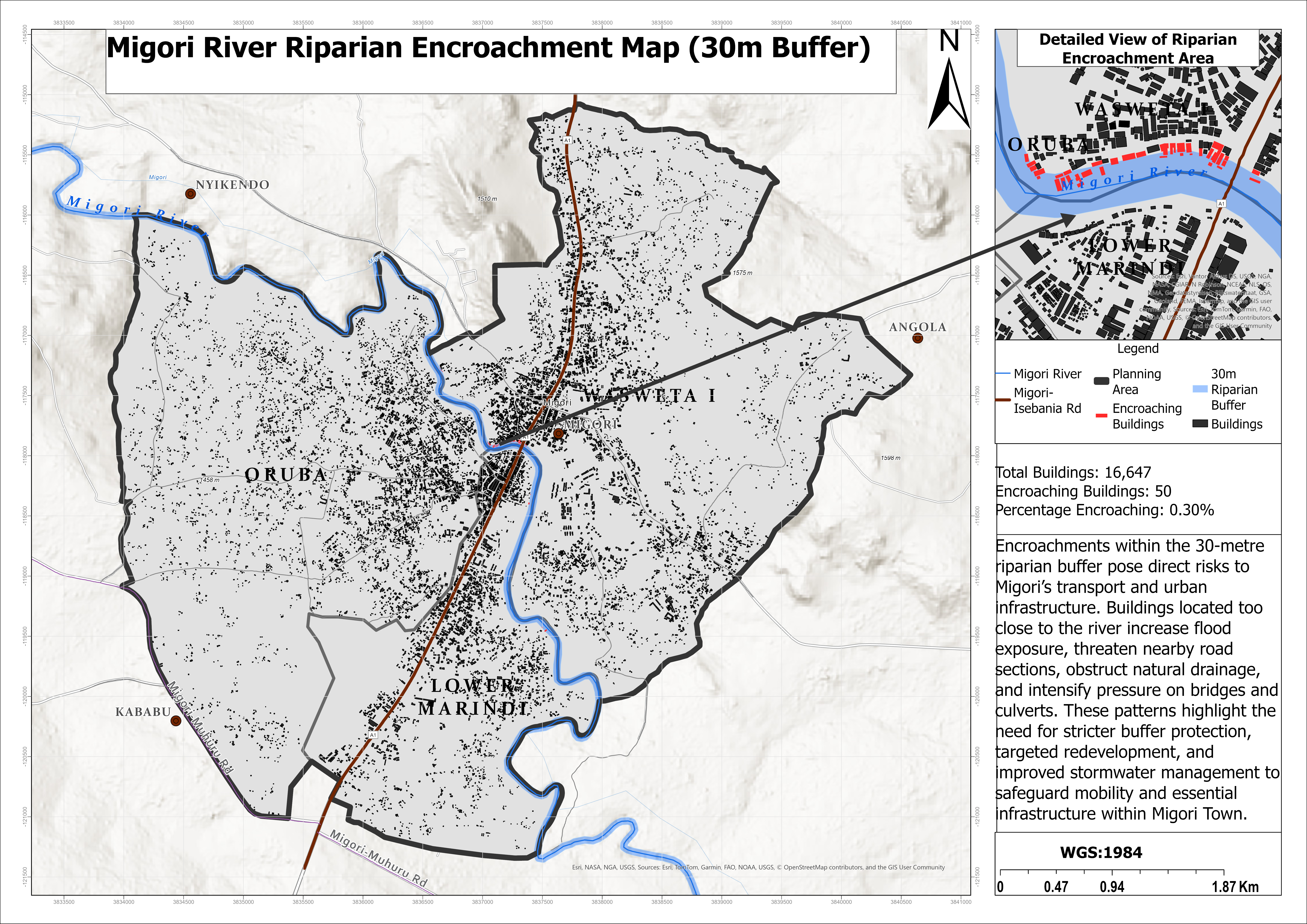
Develop a GIS workflow to identify buildings located within the legally protected 30-metre riparian buffer along Migori River using spatial analysis and proximity modeling.
The analysis integrated river networks, building footprints, and planning boundaries to quantify encroachments and produce an evidence-based map for environmental planning and development control.
What I Built
- Created a 30-metre riparian buffer around the Migori River using GIS proximity analysis
- Performed spatial overlay analysis to identify buildings intersecting protected buffer zones
- Quantified encroaching structures and calculated encroachment statistics
- Designed a professional cartographic map highlighting affected areas and development patterns
- Produced spatial evidence to support environmental protection and development control
What Changed
- Identified 50 buildings located within the protected 30-metre riparian buffer
- Quantified encroachment across 16,647 mapped buildings, providing measurable evidence for planning decisions
- Highlighted priority areas for environmental protection, flood risk mitigation, and regulatory enforcement
- Delivered a GIS-based decision-support map to guide sustainable river corridor management and urban planning