CASE STUDY
Pond Suitability Analysis
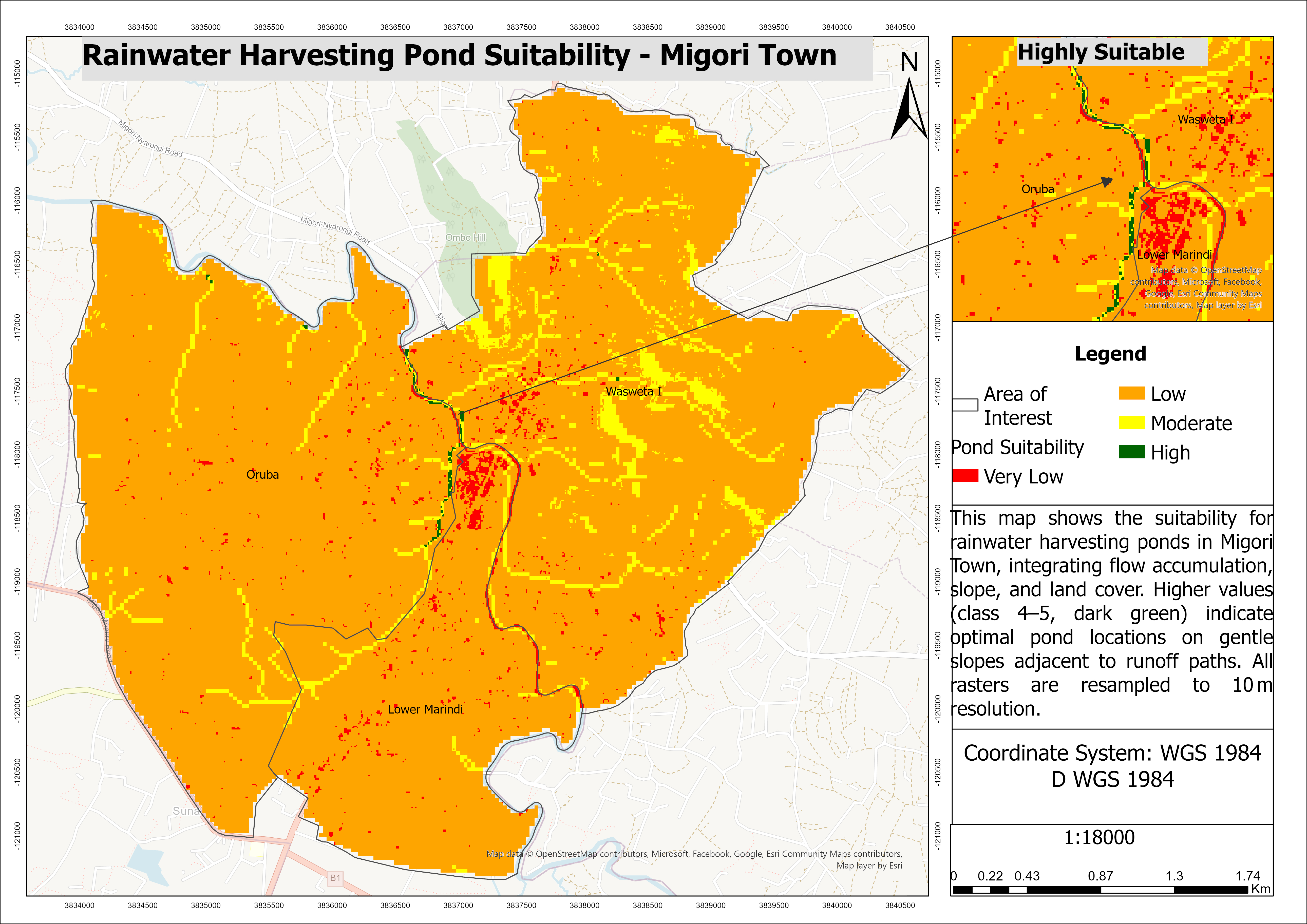
Using remote sensing, terrain analysis, and GIS-based multi-criteria evaluation to identify optimal locations for rainwater harvesting ponds in Migori Town.
ROLE
GIS & Spatial Analyst
PLATFORM
ArcGIS Pro · Sentinel-2 · DEM
FOCUS
GIS · Remote Sensing · Spatial Analysis
LIVE
The Real Problem
Identifying suitable locations for rainwater harvesting ponds requires balancing multiple environmental factors. Poor site selection can reduce water storage efficiency, increase construction costs, and limit long-term sustainability.
The Approach
Develop a GIS-based suitability model by integrating satellite imagery, digital elevation data, and hydrological analysis to evaluate the most appropriate locations for rainwater harvesting ponds.
The workflow combined supervised land-cover classification, terrain analysis, hydrological modeling, and weighted overlay analysis to produce a comprehensive suitability map for planning and decision-making.
What I Built
- Preprocessed Sentinel-2 imagery through band compositing and resolution harmonization
- Performed supervised land-cover classification into vegetation, bare soil, and urban land uses
- Generated hydrological models including Fill, Flow Direction, and Flow Accumulation from a Digital Elevation Model (DEM)
- Created and reclassified slope and hydrological suitability layers
- Designed a weighted overlay model integrating land cover (25%), slope (35%), and flow accumulation (40%) to identify optimal pond locations
What Changed
- Identified highly suitable locations for rainwater harvesting across Migori Town
- Produced a reproducible GIS workflow for multi-criteria site suitability analysis
- Demonstrated how remote sensing and spatial analytics can support sustainable water resource planning
- Delivered a professional cartographic suitability map to support evidence-based infrastructure planning